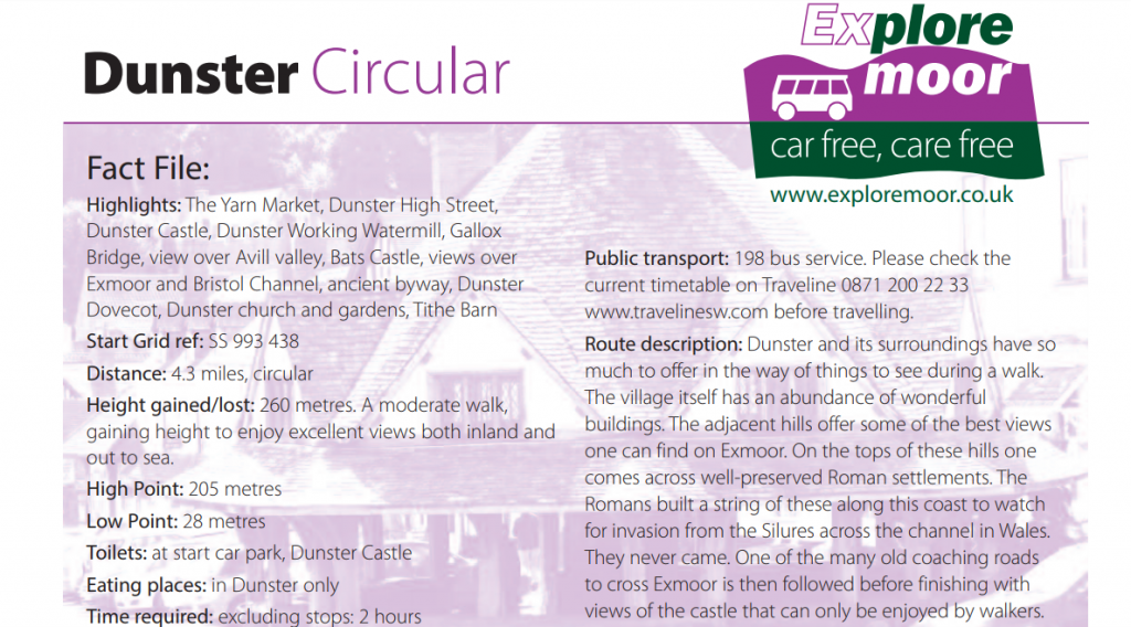
Dunster Circular Walk
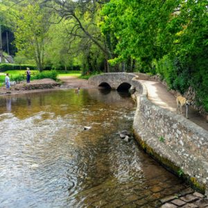
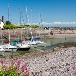
There are a number of tracks and paths extending from Dunster into the expanse of the Crown Estate and surrounding land. Walk along Dunster High Steet, past the castle then bare left down Mill Lane. You should find yourself approaching Gallox Bridge (as shown in the title image). Beyond this, at the base of the hill, is a large mounted map showing you the lay of the land. From here, you can follow any of the various tracks, or perhaps the route as described below.
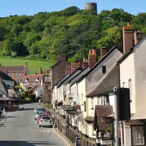
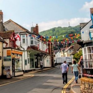
Highlights: The Yarn Market, Dunster High Street, Dunster Castle, Dunster Working Watermill, Gallox Bridge, view over Avill valley, Bats Castle, views over Exmoor and Bristol Channel, ancient byway, Dunster Dovecot, Dunster church and gardens, Tithe Barn
Start Grid ref: SS 993 438
Distance: 4.3 miles, circular
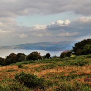
Height gained/lost: 260 metres. A moderate walk, gaining height to enjoy excellent views both inland and out to sea.
High Point: 205 metres
Low Point: 28 metres
Toilets: at start car park, Dunster Castle
Eating places: in Dunster only
Time required: excluding stops: 2 hours
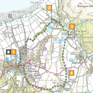
Route directions: The grid references are given should you like to follow the route on an Ordnance Survey map.
1, SS 993 438
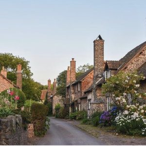
This walk starts at the main car park in Dunster, called Dunster Steep car park. From this car park walk up to the National Park Centre, continuing along the road ahead, being aware of the traffic. Follow the road round to the left into the High Street. Pass the Yarn Market and continue towards the traffic lights.
2, SS 991 436, 0.2 miles
Now continue ahead uphill towards the Castle soon bearing right downhill, leaving the Castle on your left. Pass through the gates and turn left along the main road, West Street. Shortly turn left down Mill Lane towards the Working Watermill. Cross the stream bridge with the mill leat now on your left. Shortly turn right along Mill Gardens. The watermill is just ahead if you want to visit it first, then returning to Mill Gardens.
3, SS 989 432, 0.5 miles
Pass through the barrier at the end of Mill Gardens and bear left along the road to reach Gallox Bridge, a delightful pack-horse bridge over the River Avill. Cross the bridge and keep ahead on the track past houses on your right.
4, SS 989 430, 0.6 miles
Now keep to the main track that bears slightly right, so ignoring the path on the left through the kissing gate and the path to the right and level. This track now climbs gently and quite straight through woodland.
5, SS 985 429, 0.9 miles
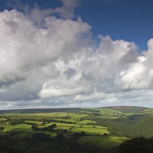
After a while ignore the track that bears off to the left uphill, instead keeping on the main track still climbing gently. A little further on ignore the path that bears off to the right downhill, instead keeping on the main track as it now bears round to the left. Look for the wonderful roots and mosses on the banks. At the top of the climb the track goes to the left. At this point just go over to your right to an excellent viewpoint over the River Avill valley, looking towards Timberscombe and Wootton Courtenay.
6, SS 981 427, 1.2 miles
Return to the main path, now effectively going straight ahead from here. Shortly take the next path that goes hard back to the left. Follow this uphill and then follow it round to the right through the gap.
7, SS 983 427, 1.4 miles
Now ignore the path to the left instead going straight ahead on the path uphill through the trees to emerge
out of the woods on the top of Gallax Hill. On your right is an old Roman settlement with the earthworks still
quite obvious. Continue ahead on the grass path.
8, SS 985 424, 1.7 miles
As the path loses a bit of height, ignore the path to the left, continuing ahead uphill again to reach Bats Castle, another Roman settlement. The path goes through the middle of this one, giving wonderful all-round views. On leaving it keep on the path ahead towards the woods, ignoring the paths off either side. Pass through the woods ahead to reach a bridle gate by a gate. Ignore the path to the left.
9, SS 993 418, 2.4 miles
Pass through the bridle gate and turn left along this ancient byway. Follow it as it loses height beside the old bank on your left with old beech trees that would have once been planted as a hedge. After a little while pass the gate to a reservoir on your left and a little further on when this track turns right, turn left here to a gate, signed to Dunster
10, SS 998 426, 3.0 miles
Pass through a plantation of ancient oak trees, keeping ahead with the Castle to your right. Keep on this path as it now loses height to a kissing gate by a gate.
Continue descending straight ahead, ignoring a path on the left, to a wooden kissing gate which accesses a minor road.
11, SS 989 430, 3.6 miles
Pass through this and turn right, back past the houses to Gallox Bridge. Bear right by the car park along Mill Gardens, bearing left along Mill Lane back to West Street.
12, SS 989 434, 3.8 miles
Turn right along the main road and opposite the gates to the castle, instead of returning that way, cross over to
go along St Georges Street opposite. Follow it as it winds right and left to reach the school.
13, SS 989 436, 4.0 miles
By the school, turn right along Priory Green, passing by the lych-gate to the church, passing through an old
brick arch to reach the Dovecot on the left and the church gardens on the right. Continue ahead to pass
the restored tithe barn on the right. Continue along this road following it round to the right near the end to go
ahead to the main road and the National Park Centre and car park.
Other posts you may be interested in;