
The Exford circular walk is a beautiful 3.8-mile route starting and ending in Exford village, taking you along the River Exe, across cultivated Exmoor farmland, and up to open moorland with spectacular panoramic views. This easy to moderate walk should take around 2 to 2.5 hours and offers a perfect introduction to the diverse landscapes of Exmoor National Park.
Planning Your Exford Circular Walk?
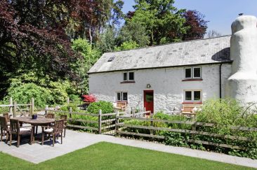
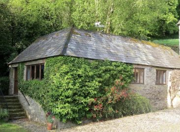
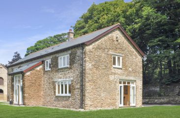
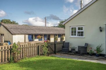
Stay right at the start of the walk! Browse our collection of holiday cottages in and around Exford – literally steps from waypoint 1.

⚡ Walk Stats at a Glance
📋 Complete Exford Circular Walk Guide:
🗺️ Exford Circular Walk: Route Overview
This beautiful Exford circular walk showcases the varied landscapes that make Exmoor National Park so special. Starting from the heart of Exford village, the route initially follows the River Exe downstream through a peaceful valley setting. After following the river, you gain elevation across cultivated Exmoor farmland, opening up to spectacular panoramic views across the moor.
The walk’s highest point rewards you with 360-degree views across central Exmoor, where on clear days you can see landmarks including Dunkery Beacon (Exmoor’s highest point) and the rolling hills that characterize this ancient landscape. The return journey descends through what’s known locally as a “hidden valley” before completing the loop back to Exford village, where traditional Exmoor pubs await.
Who Is This Walk Suitable For?
Classified as easy to moderate, this walk is suitable for:
- ✅ Regular walkers with reasonable fitness
- ✅ Families with older children (8+) comfortable with 2-2.5 hour walks
- ✅ Dog walkers (livestock present – leads required in places)
- ✅ Anyone seeking varied Exmoor landscapes in a half-day walk
- ✅ Photographers looking for moorland views and valley scenery
⚠️ Not suitable for: Pushchairs, wheelchairs, very young children, or complete beginners uncomfortable with moderate ascents.
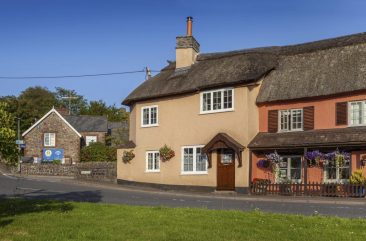
🏘️ Exford Village Guide – Complete guide to Exford with all facilities and attractions
👣 Detailed Walking Directions: Complete Route
📍 Navigation Note: The grid references below are given should you like to follow the route on an Ordnance Survey map. They are not needed to follow the route which is described very accurately in the text. These directions have been walked and verified. Grid references correspond to OS Explorer OL9 Exmoor map.
⚠️ Safety Reminder: Always carry the appropriate OS map as backup navigation. Please close all gates behind you and keep dogs on leads where livestock are present.
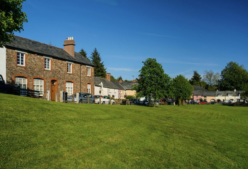
📍 Waypoint 1: Starting Point – Exford Village Green
Grid Reference: SS 853 383
Cumulative Distance: Start (0 miles)
From the bus stop by the green, cross over the main road to go into the road to the car park, opposite the Crown Hotel. Pass through the car park to go past the Exmoor National Park Field Services. Pass through the kissing gate ahead and continue ahead to the next kissing gate by the river. Continue along by the river to pass through the next kissing gate.
What to look for: The start is clearly marked by the bus stop and village green. The car park is small but obvious opposite the Crown Hotel. You’ll pass the National Park Field Services building on your right.

📍 Waypoint 2: Following the River Path
Grid Reference: SS 857 380
Cumulative Distance: 0.4 miles
Cross the road and pass through the kissing gate by the gate, effectively turning left to follow the wide path uphill. Soon ignore the path on the left to the church. At the top of the rise by an old barn, go to the stile by a gate ahead, ignoring the one up to the left.
Navigation tip: After crossing the road, turn left uphill. The church path branches off to your left – ignore this and continue straight ahead. Look for the old barn as your landmark.
📍 Waypoint 3: Climbing Through Fields
Grid Reference: SS 860 379
Cumulative Distance: 0.6 miles
Go over this stile and now follow this field’s top boundary hedged bank on your left, keeping fairly level. In the far corner, cross the stile by a gate and keep following the left boundary hedged bank to pass through a gap of trees on a bank across the field. From here, now bear slightly right to about the centre of the trees on a slope ahead of you.
Navigation tip: Keep the hedged bank on your left throughout this field. After passing through the gap of trees, look ahead for a wooded slope – aim for the centre of these trees.
📍 Waypoint 4: Through the Woods
Grid Reference: SS 866 380
Cumulative Distance: 1 mile
There you will find a metal gate and a path down through the woods to a plank-bridge over a stream and a stile. Go up the field ahead to reach the building to pass through a bridle gate on to their track.
What to look for: Metal gate marks the woodland entrance. The path descends through woods to a stream crossing via plank-bridge. After the stile, head uphill toward the building ahead.
📍 Waypoint 5: Towards Staddon Hill
Grid Reference: SS 869 380
Cumulative Distance: 1.1 miles
Turn left here towards Staddon Hill, bearing right up the concreted track to a T-junction with a small road. Turn left along it and follow until reaching a main road.
Navigation tip: After joining the track, turn left, then bear right uphill on the concrete surface. At the T-junction with the small road, turn left and continue to the main road.
📍 Waypoint 6: Stone Cross Junction
Grid Reference: SS 871 383
Cumulative Distance: 1.7 miles
Turn left to follow along the grass verge to reach the next junction with a main road (B3224, Stone Cross).
Safety note: You’re now on the B3224 main road. Use the grass verge and be aware of traffic. Stone Cross is a significant junction – a good landmark for checking your position.
📍 Waypoint 7: Stone Farm
Grid Reference: SS 867 387
Cumulative Distance: 2 miles
Carefully cross over to the driveway of Stone Farm by the letterbox. If the metal gates are closed, press the switch on the post to open them. (I think press the switch again on the other side to close them, although there was a delay in them closing for me). Follow the track ahead, ignoring all gates and tracks off. At the pond, continue ahead signed to Hillhead Cross.
Safety note: Cross the main road carefully – traffic can be fast here. The metal gates may have an automatic closing system. Be courteous and try to close gates behind you. Follow the signed track to Hillhead Cross.
📍 Waypoint 8: Memorial Stone Track
Grid Reference: SS 864 389
Cumulative Distance: 2.2 miles
Soon ignore the gate ahead and follow the track as it bears right. Stay on this rocky track and at the top go through the gate across it to the memorial stone, still on the track.
What to look for: The track becomes rockier and bears right. You’ll pass through a gate and see a memorial stone – this confirms you’re on the correct route. The track begins to gain elevation here.
📍 Waypoint 9: Hedged Bank Fields
Grid Reference: SS 863 394
Cumulative Distance: 2.5 miles
Almost immediately bear left, keeping the hedged bank on your left, to reach a stile by two gates. Ignore the left-hand gate, and continue ahead into the next field, keeping by the hedged bank on your left to a gate in the far left corner.
Navigation tip: After the memorial stone, bear left immediately. Always keep the hedged bank on your left side. At the stile with two gates, ignore the left gate and go straight ahead.
📍 Waypoint 10: Valley Descent
Grid Reference: SS 858 393
Cumulative Distance: 2.8 miles
Go through into the next field and now follow the hedged bank on your right. Shortly ignore the gate on the right and the one ahead; instead turn left to follow alongside the wire fence towards a valley. When a fence goes across you, turn left and follow the path between the gorse into the valley, following it as it swings round to the right over a stream, past ruins.
Navigation tip: This is the beginning of the “hidden valley” descent. Keep the hedge on your RIGHT now (it switches sides). Turn left when the wire fence blocks your path, then follow the valley down between gorse bushes. Old stone ruins mark the valley bottom.
📍 Waypoint 11: Stream Track
Grid Reference: SS 859 392
Cumulative Distance: 3.1 miles
Now go to the gate ahead as the track goes right to the stream. Follow the track to the next gate and now
What to look for: The track swings right toward the stream. Follow it to a gate. This waypoint leads directly to waypoint 12.
📍 Waypoint 12: Field Crossing
Grid Reference: SS 859 391
Cumulative Distance: 3.2 miles
From this stile, bear left across the field keeping almost parallel to the stream and conifer woods over to your right, towards and left of three old trees and downhill to a stile by a gate and old tree.
Navigation tip: After the stile, head diagonally left across the field. Keep roughly parallel to the stream and conifer woods on your right. Aim for three distinctive old trees – pass to the left of them, heading downhill to find the stile.
📍 Waypoint 13: Steep Descent
Grid Reference: SS 859 389
Cumulative Distance: 3.3 miles
Now go down the steep slope, keeping the hedged bank and gully on your right to a stile in the corner by the stream. Cross the stile and little bridge and follow the path ahead with the stream now on your left. Pass through the gate by the house and ignore the path up the steps, continuing ahead down the path to reach the track to that house.
Safety note: This is the steepest descent on the walk. Take care on the slope, especially if wet. Keep the hedge and gully on your right. After crossing the small bridge, the stream switches to your left side. When you reach the house, ignore the steps going up and stay on the lower path.
📍 Waypoint 14: Church View Path
Grid Reference: SS 858 388
Cumulative Distance: 3.4 miles
Bear right along it and almost immediately go left through the first gate, over the stream, through a bridle gate on the right, straight over the track up a path opposite. Follow this path over the field above the stream now down on your right. Soon the path climbs diagonally up a small hill. The church comes into view on your left.
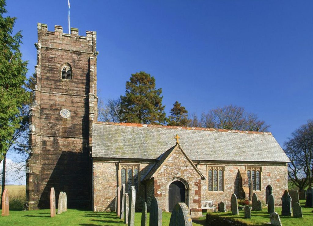
Navigation tip: This section involves several quick direction changes: right on track, immediate left through gate, cross stream, bridle gate right, then straight up path opposite. The path then climbs diagonally uphill. Exford church tower becomes visible on your left – a welcome sight indicating you’re nearly back!
📍 Waypoint 15: Final Fields
Grid Reference: SS 856 386
Cumulative Distance: 3.6 miles
Go through the kissing gate in the hedged bank ahead to go straight across this field to the next kissing gate ahead. Now go straight ahead with a wire fence on your left to the next kissing gate.
Navigation tip: Simple field crossing now. Go straight through each kissing gate. Keep the wire fence on your left in the second field. Exford village is now very close.
📍 Waypoint 16: Return to Exford Village
Grid Reference: SS 853 383
Cumulative Distance: 3.7 miles (final 0.1 miles back to start = 3.8 miles total)
From here go ahead and take the path that goes down to the right of the road with the woods on your right.
Final section: You’re back at the same grid reference as the start (SS 853 383). Take the path down to the right of the road, keeping woods on your right. This brings you back to the village green and bus stop where you started. The Crown Hotel and village pubs are now just steps away – well done!
🎉 Congratulations! You’ve completed the Exford circular walk! The village green, car park, and both of Exford’s traditional pubs (The Crown Hotel and The Exmoor White Horse) are now just moments away. Time to celebrate your achievement with well-earned refreshments!
👀 What You’ll See on the Exford Circular Walk
One of the joys of this Exford circular walk is the rich variety of landscapes, wildlife, and features you’ll encounter along the way.
🌊 River Exe & Riverside Wildlife (Waypoints 1-2)
The opening section along the River Exe provides a peaceful start to your walk. This beautiful river, near its source here on Exmoor, is home to diverse wildlife:
- Dippers – Small brown birds that bob on rocks before diving to hunt underwater insects
- Grey Wagtails – Beautiful birds with distinctive yellow undersides
- Otters – Occasionally spotted, especially at dawn or dusk
- Brown Trout – Visible in the clear water during summer
- Dragonflies & Damselflies – Common in summer months
The riverbanks are lined with wildflowers in spring and summer, including primroses, wild garlic, and bluebells in May.
🌾 Exmoor Farmland (Waypoints 2-7)
As you climb away from the river through cultivated Exmoor fields, you’re walking through traditional agricultural landscape that has been farmed for centuries:
- Sheep grazing – Hardy hill breeds suited to Exmoor conditions
- Dry stone walls – Traditional boundaries built without mortar
- Farm gates and stiles – Evidence of ancient rights of way
- Field patterns – Small irregular fields reflecting medieval farming practices
- Old barns and buildings – Like the one mentioned at waypoint 2
- Stone Farm – Working farm at waypoint 7
🏔️ Moorland Views & Landscapes (Waypoints 7-10)
The moorland section (approximately waypoints 7-10) provides the walk’s most spectacular scenery. On clear days, the views are outstanding:
Visible landmarks include:
- Dunkery Beacon (northeast) – Exmoor’s highest point at 519m
- Winsford Hill (east) – Bronze Age burial mounds on the skyline
- The Brendon Hills – Rolling hills stretching to the east
- Central Exmoor valleys – Patchwork of fields and woodland below
- Memorial stone at waypoint 8 – Historical marker on the moorland track
Moorland features to look for:
- Purple heather – At its best in August-September
- Gorse bushes – Yellow flowers nearly year-round (especially around waypoint 10)
- Exmoor ponies – Native ponies often grazing on the moorland
- Red deer – Sometimes spotted in the distance
- Buzzards – Frequently seen soaring overhead
- Skylarks – Their distinctive song fills the air in spring and summer
🏚️ The “Hidden Valley” (Waypoints 10-13)
The descent through the “hidden valley” is one of the walk’s most atmospheric sections:
- Stone ruins (waypoint 10) – Remains of old farm buildings from 18th-19th century moorland sheep farming
- Gorse-lined paths – The track winds between gorse bushes into the sheltered valley
- Stream crossings – Small streams and the “little bridge” at waypoint 13
- Old farmstead – The house at waypoint 13 with its ancient track
- Valley woodland – Increasingly wooded as you descend
⛪ Returning to Exford (Waypoints 14-16)
- Exford Church tower – Comes into view at waypoint 14, a welcome landmark indicating your return
- Village fields – Final pastoral landscape before reaching the village
- Traditional paths – You’re following routes used by Exmoor people for centuries
📸 Best Photo Opportunities
- River Exe reflections (Waypoint 1) – Best in early morning light
- Valley views looking back (Waypoints 2-3) – As you climb from the village
- 360° moorland panorama (Waypoints 8-9) – From the memorial stone area
- Exmoor ponies (Waypoints 7-10) – If encountered (photograph from respectful distance)
- Stone ruins in valley (Waypoint 10) – Atmospheric historical remains
- Hidden valley descent (Waypoints 10-11) – Gorse-lined valley path
- Church tower view (Waypoint 14) – Classic Exmoor village scene
- Exford village approach (Waypoint 16) – Church tower and village buildings
Ready to Walk the Exford Circular?
Make Exford your base and explore the best of Exmoor from your doorstep. Browse our holiday cottages in Exford village – perfect for walking holidays with the trail starting just steps away.
🚗 Parking & Getting to the Exford Circular Walk
Where to Park in Exford
Exford Village Car Park (Start Point for Walk)
Location: Center of Exford village, opposite The Crown Hotel (mentioned in waypoint 1)
Postcode: TA24 7PP
Grid Reference: SS 854 383 (adjacent to start point SS 853 383)
Capacity: Small car park (approximately 15-20 spaces)
Cost: Free
Facilities: None on-site (village pubs have toilets for customers)
Parking Tips:
- ✅ Arrive early on busy days (weekends, Bank Holidays, summer) – the car park fills quickly
- ✅ Walk starts immediately from the car park via the kissing gate mentioned in waypoint 1
- ✅ Support local businesses – Visit village pubs/tearoom after your walk
- ✅ Park considerately – Don’t block farm access or residents’ driveways
- ✅ Alternative parking – If full, limited roadside parking in village (be considerate)
Getting to Exford by Car
Exford is centrally located in Exmoor National Park:
- From Dulverton: 8 miles north on B3224 (15 minutes)
- From Porlock: 10 miles south via Exford Road (20 minutes)
- From Minehead: 12 miles via A39 then minor roads (25 minutes)
- From Taunton: 25 miles via A358 and B3224 (50 minutes)
- From Exeter: 40 miles via A361 and B3224 (1 hour 15 minutes)
- From Bristol: 50 miles via M5 and A39 (1 hour 30 minutes)
Road Note: The B3224 (mentioned at Stone Cross in waypoint 6) is the main road through Exmoor. Roads can be narrow with limited passing places. Drive carefully and be prepared to reverse to passing places.
Public Transport
Limited options:
- Nearest Train Station: Taunton (25 miles) – taxi or rental car needed from here
- Buses: Very limited service to Exford. Check seasonal Exmoor Explorer routes in summer
- Best option: Arrive by car or stay in Exford and walk from your accommodation
- Taxi services: Available from Dulverton and Minehead – book in advance
Tip: The walk description mentions the “bus stop by the green” (waypoint 1) – this is where the route starts, though regular bus services are limited.
🏡 Where to Stay Near Exford for Walking
Staying in or near Exford village puts you right at the start of this walk (literally steps from the car park mentioned in waypoint 1). Wake up, have breakfast, and you’re on the trail in minutes. Here are our recommended Exford holiday cottages perfect for Exmoor walking holidays:
Why Stay in Exford for Walking?
- ✅ Walk starts from your doorstep – No driving to trailheads or worrying about parking
- ✅ Central Exmoor location – Access to all parts of National Park within 30 minutes drive
- ✅ Multiple walks available – Dunkery Beacon, Winsford Hill, Exe Valley trails all nearby
- ✅ Traditional village pubs – The Crown Hotel and Exmoor White Horse perfect for post-walk refreshments
- ✅ Village shop – Walking supplies, picnic food, and essentials
- ✅ Exford Bridge Tearoom – Excellent for breakfast before walks or afternoon tea after
- ✅ Authentic Exmoor experience – Working village in the heart of the National Park, not touristy
- ✅ Dark Sky Reserve – Exford is within Europe’s first International Dark Sky Reserve
- ✅ No vehicle movement needed – Pub, shop, walks all walkable from accommodation
Browse our complete collection of holiday cottages in and around Exford.
⚠️ Practical Information & Safety
What to Bring – Essential Items
✅ Must-Have Items:
- Proper walking boots – Paths can be muddy (especially waypoints 4, 10-13) and uneven throughout
- OS Map – Explorer OL9 Exmoor (essential backup even with detailed directions and grid references)
- Waterproof jacket – Exmoor weather changes quickly, especially on exposed moorland (waypoints 7-10)
- Water – Minimum 1 liter per person (no facilities between start and finish)
- Snacks/lunch – No cafés or shops on route
- Mobile phone – For emergencies (generally good signal throughout)
- This route description – Printed or downloaded with all 16 waypoints
- Basic first aid kit – For minor injuries
☑️ Recommended Items:
- Compass – For use with OS map and grid references
- Walking poles – Helpful on descents, especially the steep section at waypoint 13
- Sun protection – Hat and sunscreen (summer)
- Extra warm layer – Can be cold on moorland even in summer
- Camera – Many photo opportunities throughout
- Binoculars – For distant views and wildlife spotting
- GPS device or smartphone GPS app – Can help confirm waypoint locations
- Small backpack – To carry everything comfortably
Weather Considerations
Exmoor weather is notoriously changeable – be prepared:
- Summer (June-August): Can be warm but prepare for rain. The moorland section (waypoints 7-10) can be hot with little shade. Midges possible in calm conditions near the stream sections. Heather blooms in August-September.
- Autumn (September-November): Beautiful heather colors and autumn foliage. Increasing wind and rain. Days getting shorter – start early. Paths muddier, especially the woodland sections.
- Winter (December-February): Short days (sunset ~4pm). Very cold on exposed moorland section. Muddier paths throughout. The steep descent at waypoint 13 can be treacherous when wet. Beautiful in frost or light snow but check conditions carefully.
- Spring (March-May): Often driest season. Wildflowers abundant, especially along river (waypoint 1). Weather still variable. Ground-nesting birds present – keep dogs under close control.
Always check forecast before starting: The moorland section (waypoints 7-10) is particularly exposed and can be unpleasant or even dangerous in strong wind, heavy rain, or poor visibility.
Safety Considerations
⚠️ Important Safety Points:
- Tell someone where you’re going and expected return time (allow 3 hours to be safe)
- Check weather forecast before setting out – avoid if severe weather predicted
- Carry OS map – Don’t rely solely on these directions or phone GPS
- Mobile signal – Generally good but may be weak in valleys (waypoints 10-13)
- Livestock present throughout – Sheep and possibly cattle. Keep dogs under control at all times
- Close all gates behind you (especially around waypoints 3-6, farmland areas)
- Be cautious at waypoint 7 – Crossing the B3224 main road requires care (traffic can be fast)
- Steep descent at waypoint 13 – Take extra care here, especially if ground is wet
- Stream crossings – At waypoints 4, 10, 11, 13, 14 – can be slippery
- Metal gates at waypoint 7 – Take care with automatic closing mechanism
- Emergency: 999 or 112. For mountain rescue, ask for “Police” then “Exmoor Search and Rescue”
- Know your route – Study the 16 waypoints before starting
Walking with Dogs
Dogs are welcome on this walk, but please note:
- ✅ Keep on leads in all farmland sections (waypoints 2-7 especially) where livestock are present
- ✅ Under close control on moorland (waypoints 7-10) due to ground-nesting birds (March-July particularly)
- ✅ Bag and bin dog waste (bins available in Exford village at start/finish)
- ⚠️ Sheep farming – This is working farmland throughout. Dogs must not disturb or chase sheep
- ⚠️ Multiple stiles – Present throughout the route. Most are dog-negotiable but consider your dog’s size and agility. The stile at waypoint 3 and those at waypoints 12-15 are typical Exmoor field stiles
- ⚠️ Stream crossings – Several throughout (waypoints 4, 10, 13, 14) – some dogs may need encouragement
- Water for dogs – Bring water for your dog, though stream water is generally accessible at several points
Best Time of Year & Day
This walk can be enjoyed year-round, but:
Best Months:
- May-October: Best weather conditions and longer daylight hours
- August-September: Spectacular purple heather on the moorland (waypoints 7-10)
- Spring (April-June): Wildflowers and riverside flora at best (especially waypoint 1-2)
- Late May: Bluebells in woodland sections
- October: Beautiful autumn colors in the “hidden valley” (waypoints 10-13)
Best Time of Day:
- 9-10am start: Good light for photos, avoids parking issues, ensures completion in daylight
- Early morning: Best for wildlife spotting and quieter paths
- Avoid late afternoon starts – Allow 2.5 hours minimum for completion
- Winter: Must start by 1pm latest to finish before dark (~4pm sunset)
Accessibility
This walk is NOT suitable for:
- ❌ Wheelchairs – Multiple stiles, uneven terrain, steep sections
- ❌ Pushchairs – Stiles and rough paths make this impossible
- ❌ Very young children – 3.8 miles with elevation may be too much
- ❌ Complete beginners – The navigation (even with 16 waypoints) requires map reading ability
- ❌ People with mobility issues – Multiple stiles and steep descent at waypoint 13
✅ Suitable for: Families with children 8+ who regularly walk, fit adults, experienced walkers seeking a moderate half-day route.
Planning Your Exford Walk?
Stay right at the start of the walk! Browse our collection of holiday cottages in and around Exford – literally steps from waypoint 1.
❓ Frequently Asked Questions About the Exford Circular Walk
How long does the Exford circular walk take?
The Exford circular walk takes 2 to 2.5 hours at a moderate, steady pace. Faster, experienced walkers may complete the 3.8 miles in under 2 hours, while those stopping frequently for photos, wildlife watching, or rest breaks might take 3 hours. The 180 meters of elevation gain (particularly the climbs from waypoints 2-6 and the steep descent at waypoint 13) will affect timing. Allow 2.5-3 hours to walk comfortably without rushing.
Where do I park for the Exford circular walk?
Park in Exford village car park (postcode TA24 7PP, grid reference SS 854 383), located opposite The Crown Hotel. This free car park is mentioned in the walk directions at waypoint 1 and provides immediate access to the start of the route via the kissing gate to the Exmoor National Park Field Services. The car park is small (15-20 spaces), so arrive early on busy days. If full, limited considerate roadside parking is available in the village.
Do I need a map for the Exford circular walk?
Yes, you should carry OS Explorer map OL9 Exmoor as essential backup navigation. While this guide provides detailed directions for all 16 waypoints with grid references, having the map allows you to confidently navigate if you become uncertain, see the surrounding area in context, and plan escape routes if needed. The route crosses varied terrain including farmland (waypoints 2-7), moorland (waypoints 7-10), and the “hidden valley” (waypoints 10-13), and while generally well-walked, some sections are less obvious. Don’t rely solely on smartphone GPS – carry a proper map and compass.
Is the Exford circular walk suitable for beginners?
The walk is rated easy to moderate, suitable for most people with reasonable fitness and some walking experience. Complete beginners might find the 3.8-mile distance, 180m elevation gain, and navigation challenging. The route includes multiple stiles, uneven terrain, farmland paths that can be muddy, a steep descent (waypoint 13), and requires basic map-reading skills even with the 16 waypoints provided. Proper walking boots are essential. Regular walkers, families with older children (8+), and anyone who walks occasionally should find it comfortable and achievable.
Can I take my dog on the Exford circular walk?
Yes, dogs are welcome but must be kept on leads throughout the farmland sections (especially waypoints 2-7) where livestock, particularly sheep, are present. The walk passes through active working farmland, so responsible dog ownership is essential. Most stiles are dog-negotiable, though smaller dogs may need help. There are stream crossings (waypoints 4, 10, 13, 14) which some dogs may need encouragement to cross. Keep dogs under close control on the moorland section (waypoints 7-10) due to ground-nesting birds. Please bag and bin dog waste in Exford village.
What’s the best time of year for the Exford circular walk?
The walk can be done year-round, but May to October offers the best conditions with longer daylight and generally better weather. August-September is particularly beautiful when the moorland heather (visible from waypoints 7-10) is in bloom with stunning purple colors. Spring (April-June) brings wildflowers along the riverside sections and in the “hidden valley.” Autumn offers beautiful colors. Winter walks are possible but require proper preparation – the exposed moorland section can be very cold, days are short (sunset ~4pm), and the steep descent at waypoint 13 can be treacherous when wet or icy. Always check weather forecasts regardless of season.
Will I see Exmoor ponies on this walk?
There’s a good chance of seeing Exmoor ponies, particularly on the moorland section between waypoints 7-10. These native ponies graze freely across Exmoor and are often spotted on the open moorland you cross. They’re semi-wild animals, so if you see them, observe from a respectful distance and don’t approach, touch, or feed them. Bring binoculars for better views. You may also spot red deer in the distance, especially early morning or evening, and buzzards are frequently seen overhead throughout the walk.
Are there any facilities on the Exford circular walk?
There are no facilities on the walk itself – no cafés, toilets, shops, or benches once you leave Exford village at waypoint 1 until you return at waypoint 16. Use facilities in Exford before starting. The Crown Hotel and Exmoor White Horse Inn have toilets for customers and serve excellent food and drinks (perfect after your walk). Exford Bridge Tearoom is also worth a visit. You must bring sufficient water and snacks/lunch as there’s nowhere to buy refreshments en route. There are streams at several waypoints, but carry your own water.
Is mobile phone signal available on the Exford circular walk?
Mobile signal is generally good around Exford village (waypoints 1, 15-16) and on most of the moorland section (waypoints 7-10). Signal may be weaker or intermittent in some valley sections, particularly the “hidden valley” (waypoints 10-13), but is usually sufficient for emergency calls. Always carry a phone for safety and emergency use, but don’t rely solely on smartphone GPS for navigation – bring OS map and compass as primary navigation tools. Download offline maps before starting if relying on phone GPS.
What is the hardest part of the Exford circular walk?
The hardest section is the steep descent at waypoint 13, where you go down a steep slope keeping the hedged bank and gully on your right to reach a stile by the stream. This section can be slippery when wet and requires care. The other challenging sections are the gradual climbs through farmland (waypoints 2-6, gaining elevation) and navigating through the “hidden valley” (waypoints 10-13) where the path is less obvious in places. The moorland section (waypoints 7-10) is physically easier but can be mentally challenging in poor weather due to exposure. Overall, the walk is well within most people’s capabilities if properly equipped.
Can I do the walk in reverse (anti-clockwise)?
Yes, you can walk the route in reverse, starting at waypoint 16 and working back to waypoint 1. However, these directions are written for clockwise direction, so you’ll need to carefully reverse all instructions. Walking anti-clockwise means you’ll face the steep section at waypoint 13 as an ascent rather than descent, which some people find easier. The moorland views (waypoints 7-10) are visible from both directions. If walking reverse, pay extra attention to navigation as the directions reference landmarks “ahead” and “behind” based on clockwise travel.
What should I do if I get lost on the walk?
If you become uncertain of your position: 1) Stop and don’t continue blindly. 2) Check your OS map (Explorer OL9) using the grid references provided for all 16 waypoints. 3) Look for landmarks mentioned in the waypoint descriptions. 4) Use compass to orientate your map. 5) If you have signal, you can call for advice (The Crown Hotel: 01643 831554) or in emergency 999. 6) The walk is never far from civilization – the furthest point (waypoint 10) is only 2.8 miles from Exford. 7) If in doubt, retrace your steps to the last confirmed waypoint. The B3224 road (waypoint 6-7) is a good reference point if you need to return to start.
🔗 More Exmoor Walks You’ll Enjoy
If you enjoyed this Exford circular walk, explore these other Exmoor walking routes:
More Walks from Exford Village:
- 🏔️ Exford to Dunkery Beacon – 6-mile round trip to Exmoor’s highest point (519m). The summit is visible from waypoints 8-9 of this walk.
- 🌊 Exe Valley Walk – Follow the River Exe downstream through beautiful countryside from Exford
- ⛰️ Winsford Hill from Exford – Explore Bronze Age burial mounds and open moorland. See Winsford Hill in the distance from waypoints 8-10.
- 🏰 Exford to Simonsbath – Historic moorland walk to Exmoor’s highest village
Similar Easy-Moderate Circular Walks on Exmoor:
- 🏰 Dunster Circular Walk – Explore Dunster Castle estate and surrounding woodland (similar difficulty)
- 🌊 Porlock Weir to Porlock – Coastal and woodland circular walk (4 miles)
- ⛰️ Valley of Rocks Circular – Dramatic coastal scenery near Lynton (3.5 miles)
- 🌲 Dunkery & Horner Wood Walk – Woodland and moorland circular (3 miles, 1 hour)
Exmoor Landmarks Referenced in This Walk:
- 🌉 Tarr Steps – Ancient clapper bridge and riverside walks (visible from some high points)
- 🏔️ Dunkery Beacon – Multiple routes to Exmoor’s highest summit (visible from waypoints 8-10)
- 🏘️ Exford Village Guide – Complete guide to Exford with all facilities and attractions
Walking Resources:
- 🗺️ Best Walking Routes & Resources on Exmoor – OS Maps, apps, books, and trail guides
- 👣 Top 10 Exmoor Walking Spots – Starting places for more walks
Browse all our Exmoor circular walks.
Final Thoughts: Completing the Exford Circular Walk
The Exford circular walk is a wonderfully rewarding route that showcases the best of Exmoor National Park in a manageable half-day walk. With its combination of peaceful riverside walking along the River Exe (waypoints 1-2), traditional farmland with ancient boundaries (waypoints 2-7), spectacular moorland views (waypoints 7-10), and the atmospheric descent through the “hidden valley” (waypoints 10-13), this 3.8-mile route offers remarkable variety and beauty.
The detailed waypoint system with 16 numbered points and grid references ensures confident navigation, making this walk accessible to anyone with basic map-reading skills and reasonable fitness. The return to Exford village means you can enjoy well-earned refreshments at traditional Exmoor pubs – The Crown Hotel or The Exmoor White Horse – or visit the excellent Exford Bridge Tearoom.
Whether you’re a regular Exmoor visitor or discovering the area for the first time, this walk provides an excellent introduction to the landscapes that make this corner of Somerset so special. From the working farmland that has shaped Exmoor for centuries, to the wild moorland that remains largely unchanged since medieval times, to the hidden valleys that sheltered ancient farming communities, every section tells a story of this remarkable landscape.
Remember to:
- ✅ Carry OS Explorer Map OL9 Exmoor
- ✅ Check weather forecast before setting out
- ✅ Tell someone your plans
- ✅ Close all gates (especially in farmland sections)
- ✅ Keep dogs on leads where livestock present
- ✅ Bring water and snacks – no facilities en route
- ✅ Allow 2.5-3 hours for comfortable completion
Explore More Exford Content:
- 🏘️ Complete Exford Village Guide – Everything you need to know about Exford
- 🥾 All Exmoor Circular Walks – Discover more routes
- 🏡 Exford Holiday Cottages – Stay in the heart of Exmoor
- 🗺️ The Best of Exmoor Home – All our Exmoor guides and accommodation
📝 Route Information & Disclaimer
Route Directions: These walking directions have been carefully transcribed from the original route card with minor improvements for clarity and safety. All 16 waypoints with grid references are preserved exactly as originally documented.
Last Verified: November 2025
Disclaimer: Walking routes can change due to weather, land management, livestock movement, or other factors beyond our control. While we work to keep this guide accurate and have preserved the original waypoint system exactly, always use appropriate OS maps (Explorer OL9 Exmoor), check current conditions, and make your own safety assessment before setting out. Conditions can vary by season – paths that are easy in summer may be muddy or difficult in winter. The Best of Exmoor accepts no responsibility for any issues encountered while following this route. The grid references and waypoints are provided for navigation assistance and should be used in conjunction with proper OS mapping. Always follow the Countryside Code, respect farmland, keep gates closed, and keep dogs under control around livestock.
Emergency Contacts: 999 or 112 for emergencies. Ask for “Police” then “Exmoor Search and Rescue” if mountain rescue needed.
Happy walking! We hope you enjoy this beautiful Exford circular walk as much as we do.